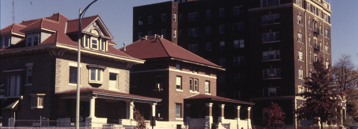
Photograph of the west side of the 100 block of Brooklyn Avenue, looking north from
132 Brooklyn in the 1980s. A three-story apartment building at 122 Brooklyn stands toward the
right side of the image.
132 Brooklyn in the 1980s. A three-story apartment building at 122 Brooklyn stands toward the
right side of the image.
1980 (year approximate) to 1989 (year approximate)
Photograph, looking north, circa 1980s of homes on the east side of the 100 block of
Garfield Avenue. On the far right is a single family home at 121 Garfield Avenue, built in
1981. To the north, in the middle of the photo, is the single family home at 119 Garfield
Avenue, built in 1884. Further north, the white house at 115 Garfield Avenue has been
demolished since the photo was taken. 121 Garfield Avenue and 119 Garfield Avenue were placed
on the Kansas City Register of Historic Places as part of the Pendleton Heights Historic
District in 1992. Located in the Pendleton Heights neighborhood.
1980 (year approximate) to 1989 (year approximate)
Photograph of a house at 100 East 34th Street in the early 1980s. The area, south of
Linwood Boulevard to 34th Terrace, between Main and Gillham, was deemed blighted and ridden
with crime and drugs in the late 1980s, and this house, as well as other homes, apartments,
and commercial buildings, were demolished in the early and mid-'90s as part of the so-called
"Glover Plan" to be replaced by the Midtown Marketplace development, a large
commercial development anchored by big box retailers Home Depot and Costco.
1980 (year approximate) to 1989 (year approximate)
Photograph circa 1980s of a single family home at 100 East 63rd Street, built in 1900.
Located in the Brookside neighborhood.
Located in the Brookside neighborhood.
1980 (year approximate) to 1989 (year approximate)
Photograph circa 1980s of a single family home at 100 E 63rd Street, built in 1900.
Located in the Brookside neighborhood.
Located in the Brookside neighborhood.
1980 (year approximate) to 1989 (year approximate)
Photograph circa 1980s of a single family home at 100 East 63rd Street, built in 1900.
Located in the Brookside neighborhood.
Located in the Brookside neighborhood.
1980 (year approximate) to 1989 (year approximate)
Photograph circa 1980s of the back of the single family home at 100 E 63rd Street that
is visible from 62nd Terrace, built in 1900. Located in the Brookside neighborhood.
is visible from 62nd Terrace, built in 1900. Located in the Brookside neighborhood.
1980 (year approximate) to 1989 (year approximate)
Photograph of a multi-family residential building under construction at the northeast
corner of 30th and Walnut circa 1983. The homes were built as part of a major Union Hill
redevelopment project that involved new construction and renovation of some existing
houses.
corner of 30th and Walnut circa 1983. The homes were built as part of a major Union Hill
redevelopment project that involved new construction and renovation of some existing
houses.
1983 (year approximate)
Photograph circa 1980s of the apartment building at 100-06 West Armour Boulevard.
Built in 1902-03 and designed by architect John W. McKecknie, it underwent a major renovation
sometime after 2012 and has been renamed as The Colonnade Apartments, along with the apartment
buildings on the rest of the block, west toward Wyandotte Street. It was placed on the
National Register of Historic Places as part of the Armour Boulevard Multiple Resource Area in
1983 and on the the Kansas City Register of Historic Places as part of the Old Hyde Park
Historic District in 1994. Located in the Midtown neighborhood.
1980 (year approximate) to 1989 (year approximate)
Photograph of houses on the north side of 34th Street between Main Street and Warwick
Boulevard in the early 1980s. The house in the foreground of the image was located at 116 East
34th Street. The area, south of Linwood Boulevard to 34th Terrace, between Main and Gillham,
was deemed blighted and ridden with crime and drugs in the late 1980s, and this house, as well
as other homes, apartments, and commercial buildings, were demolished in the early and
mid-'90s as part of the so-called "Glover Plan" to be replaced by the Midtown
Marketplace development, a large commercial development anchored by big box retailers Home
Depot and Costco.
1980 (year approximate) to 1989 (year approximate)
Photograph of houses on north side of 34th Street between Main Street and Warwick
Boulevard in the early 1980s. The house in the foreground of the image was located at 116 East
34th Street. The area, south of Linwood Boulevard to 34th Terrace, between Main and Gillham,
was deemed blighted and ridden with crime and drugs in the late 1980s, and this house, as well
as other homes, apartments, and commercial buildings, were demolished in the early and
mid-'90s as part of the so-called "Glover Plan" to be replaced by the Midtown
Marketplace development, a large commercial development anchored by big box retailers Home
Depot and Costco.
1980 (year approximate) to 1989 (year approximate)
Photograph of houses on the north side of 34th Street between Main Street and Warwick
Boulevard in the early 1980s. The green house at the left edge the image was located at 116
East 34th Street. The area, south of Linwood Boulevard to 34th Terrace, between Main and
Gillham, was deemed blighted and ridden with crime and drugs in the late 1980s, and this
house, as well as other homes, apartments, and commercial buildings, were demolished in the
early and mid-'90s as part of the so-called "Glover Plan" to be replaced by the
Midtown Marketplace development, a large commercial development anchored by big box retailers
Home Depot and Costco.
1980 (year approximate) to 1989 (year approximate)
Photograph of buildings on the south side of the 1000 block of 39th Street, circa
1990. Three two-story apartment buildings stretch from 1009-19 W. 39th. The small Colonial
style office building at 1001 W. 39th was demolished in 2009 to allow for new
construction.
1990. Three two-story apartment buildings stretch from 1009-19 W. 39th. The small Colonial
style office building at 1001 W. 39th was demolished in 2009 to allow for new
construction.
1990 (year approximate)
Photograph of a house at 1000 East 29th Street in the early 1980s. The house was
demolished in 2003. The majority of houses and businesses on the block, bound by 28th and 29th
and Harrison and Troost, were demolished during the 2000s after being purchased by the Kansas
City School District.
demolished in 2003. The majority of houses and businesses on the block, bound by 28th and 29th
and Harrison and Troost, were demolished during the 2000s after being purchased by the Kansas
City School District.
1980 (year approximate) to 1989 (year approximate)
Photograph of an apartment building at 1000-02 East 33rd Street in the early 1980s.
The majority of the houses and apartments on this block were demolished in the decades
following the photograph.
The majority of the houses and apartments on this block were demolished in the decades
following the photograph.
1980 (year approximate)
Photograph circa 1980s of a single family home at 1002 Greenway Terrace, built in
1928. Located in the Armour Fields neighborhood.
1928. Located in the Armour Fields neighborhood.
1980 (year approximate) to 1989 (year approximate)
Photograph of a multi-family townhouse building at 1003 West 38th Street in the early
1980s. A twin building faces the photographed building to its west on 38th Street.
1980s. A twin building faces the photographed building to its west on 38th Street.
1980 (year approximate) to 1989 (year approximate)
Photograph of a single-family residence at 1004 West 52nd Street in the 1980s. The
house was designed by local architect Mary Rockwell Hook, and built for her parents, Captain
and Mrs. Bertrand Rockwell, in 1908-09.
house was designed by local architect Mary Rockwell Hook, and built for her parents, Captain
and Mrs. Bertrand Rockwell, in 1908-09.
1980 (year approximate) to 1989 (year approximate)
Photograph of a building and storefront at the corner of Linwood and Harrison circa
1981. The location was a Safeway grocery store in the '30s, then housed a Western Auto store
from the 1940s until August, 1979, and later became home to the Paul Mesner Puppet Theater.
The building was vacant at the time of the photograph.
1981. The location was a Safeway grocery store in the '30s, then housed a Western Auto store
from the 1940s until August, 1979, and later became home to the Paul Mesner Puppet Theater.
The building was vacant at the time of the photograph.
1981 (year approximate)
Photograph of a house at 1008 East 44th Street in the early 1980s.
1980 (year approximate) to 1989 (year approximate)
Photograph circa 1980s of a single family home at 1009 Emanuel Cleaver II Boulevard,
demolished in 2007. Located in the Rockhill neighborhood.
demolished in 2007. Located in the Rockhill neighborhood.
1980 (year approximate) to 1989 (year approximate)
Photograph of a house at 101 East 36th Street in the early 1980s. The home, built
circa 1903 and designed by architecture firm Root and Siemens, was occupied by a nursing home
at the time of this photo and into the 1990s.
circa 1903 and designed by architecture firm Root and Siemens, was occupied by a nursing home
at the time of this photo and into the 1990s.
1980 (year approximate) to 1989 (year approximate)
Photograph of a house at 101 East Armour Boulevard in the early 1980s. The house,
built for Sunshine Biscuits founder Jacob Loose in 1910, was designed by architect George
Oakley Totten, but was converted to office use after the Loose family vacated the mansion in
1928. At the time of the photograph, the building the headquarters of the Operating Engineers
Local 101 union. The building was sold to a new owner at auction in 1983.
1980 (year approximate) to 1989 (year approximate)


