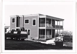
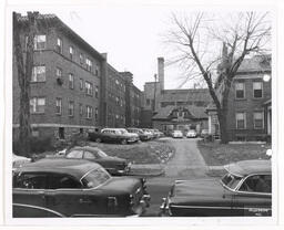
View looking northwest of the apartment building at 2990 Grand Avenue.
1980 (year approximate)
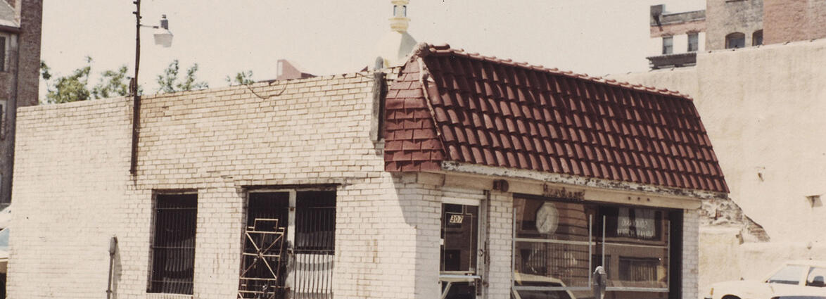
View of a building that once stood at 307 10th Street. The view is facing southwest. A car parked along 10th Street can be seen.
1983 (year approximate)
View of a building that once stood at 311 10th Street. The view is facing southwest. The building displays signs for the dentist office of Dr. W. B. Smith. The rear of the Coates House Hotel can be seen in the background. Cars can be seen parked to the side of the building and along 10th Street.
1983 (year approximate)
View facing north along Woodland Avenue from its intersection with 31st Street. A sign advertising Royal Crown Cola can be seen on the west side of the street. A sign advertising sewing machine sales and repair can be seen in front of the Woodland Hardware building. A delivery truck for the Franklin Ice Cream Company is parked in front of Woodland Hardware. Cars, a truck and pedestrians can be seen along Woodland Avenue.
1948-07-16
View facing north along Woodland Avenue from its intersection with 31st Street. A sign advertising Royal Crown Cola can be seen on the west side of the street. A sign advertising sewing machine sales and repair can be seen in front of the Woodland Hardware building. Cars, a truck and pedestrians can be seen along Woodland Avenue.
1948-07-16
View of 40th Street facing west taken from its intersection with Pennsylvania Avenue in Westport. The Kansas City Water Works Repair Department Building can be seen on the south side of the street. Several parked cars and a delivery truck traveling east along 40th Street are in view.
1950 (year approximate)
View of 47th Street or Brush Creek Boulevard facing west in the Country Club Plaza. The Bartleston Apartment Building once located at 410 W. 47th Street can be seen on the north side of the street. Several cars traveling west and parked along the street can be seen.
1945 (year approximate)
View of the stone foundation of the Carlson House that once stood on the northeast corner of the intersection of 46th Street and Pennsylvania Avenue.
1950 (year approximate)
View facing west along 54th Street from its intersection with Garfield Avenue in the Blue Hills neighborhood. Houses and trees lining the street can be seen.
1947-07-21
Exterior view of residence at 612 Brush Creek Boulevard in the Rockhill neighborhood.
View facing east along 9th Street from its intersection with Main Street. The Waltower Building on the northeast corner of 9th and Walnut streets can be seen on the north side of the street. The Fidelity National Bank Building on the southeast corner of 9th and Walnut streets and the Union National Bank Building on the southwest corner of 9th and Walnut streets can be seen on the south side of the street. Signs for the Junction Buffet, Country Club Beer and MobilGas can be seen. Pedestrians and cars along 9th Street are in view.
1949-06-05
View of apartment buildings that once occupied the southeast corner of 48th Street and Belleview Avenue in the Country Club Plaza. The view is facing southeast. The corner of the Mosley Drug Store on the southwest corner of the same intersection can be seen. A car parked along 48th Street is in view.
1945 (year approximate)
View of the back side of the Royal Building that once stood at 1016 Central Street. The view is facing northeast. Several cars parked behind and to the side of the building can be seen.
1983 (year approximate)
View facing north along Baltimore Avenue from south of 39th Street in the Old Westport Residential District. Houses, apartment buildings and cars parked along Baltimore Avenue can be seen. The Alcazar Hotel can be seen on the west side of the street. A sign for Deluxe Laundry and Cleaners and the Calvary Baptist Church are in view on the east side of the street.
1950 (year approximate)
View facing west along Brush Creek Parkway from near its intersection with Woodland Avenue in the Ivanhoe Residential District. Cars traveling along Brush Creek Parkway can be seen. The Village Green Apartments are in view.
1950 (year approximate)
View of the rear side of a building once located at 3522-3524 Main Street. The name Dr. W. R. Fricke, whose osteopathy practice was once located in the 3524 Main Street building can be seen. A car and a truck parked behind the building are in view.
1950 (year approximate)
View facing south from north of 3rd Street between Walnut Street and Grand Avenue in the River Market. Two railroad cars situated between two City Market buildings are in view. Cars and a truck parked along 3rd Street can be seen. The downtown skyline can be seen in the distance.
1950 (year approximate)
View of buildings on the northeast corner of Archibald and Pennsylvania avenues in Westport. Cars parked along Pennsylvania Avenue can be seen.
1950 (year approximate)
View of the reverse sides of several buildings once occupying the southwest corner of 30th Troost Avenue. A chimney from the Continental Baking Company Building can be seen in the background.
1945 (year approximate)
View facing northwest of the Butler Brothers Company Building at 804 Broadway Boulevard in the Wholesale Garment Historic District. When this image was captured, a sign advertising its occupant Kitco International can be seen. A portion of the Goldstandt-Powell Hat Company Building at 804 Broadway Boulevard can be seen on the left hand side of the image, and a portion of the Harvey-Dutton Dry Goods Company Building, or Issacs Building, at 800 Broadway Boulevard can be seen.
1985 (year approximate)
View facing southwest of the Cain-Grant African Methodist Episcopal Church, once located at 1701 Linwood Boulevard in the Ivanhoe Residential District. The building was previously the home of the Beth Hamidrosh Synagogue.
View of the Continental Baking Company Building located on the northeast corner of 30th Street and Troost Avenue. The view is facing west along 30th Street and captures a portion of the south side of the building. A Wonder Bread-Hostess delivery truck, automobiles, workers and pedestrians can be seen.
1954 (year approximate)
View of the Continental Baking Company Building located on the northeast corner of 30th Street and Troost Avenue. A Wonder Bread delivery truck can be seen on 30th Street. A sign advertising Country Club Beer is also in view. Several workers and pedestrians can be seen.
1945 (year approximate)
View of the Continental Baking Company Building located on the northeast corner of 30th Street and Troost Avenue. The view is facing west along 30th Street and captures a portion of the south side of the building. Wonder Bread-Hostess delivery trucks, automobiles, workers, pedestrians and MobilGas automobile service station can also be seen.
1954 (year approximate)
View of the Continental Baking Company Building located on the northeast corner of 30th Street and Troost Avenue. The view is facing west along 30th Street and captures a portion of the south side of the building. A Wonder Bread-Hostess delivery truck, automobiles, workers and pedestrians can be seen.
1954 (year approximate)


